... as reported by DancesWithSandyBottom
After a shower and some good sleep, a good tide-favorable time to leave Cedar Key will be 10:30 AM on Friday (Day28). The distance to the finish line at Ft. DeSota will be 120 miles.
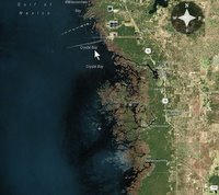
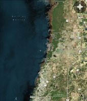
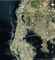
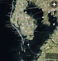
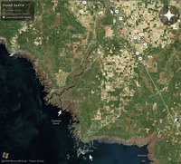
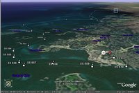
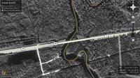
This is Stage5; "the sprint to the finish". Here are some views of the course from Cedar Key to Ft. DeSoto. (www.flashearth.com)
SandyBottom left Cedar Key at about 10:30 AM with the tide and paddled until past midnight. There was no moon light. The weather was relatively calm.
Paddling about 3-4 miles off shore Friday night, SandyBottom and DrKayak found themselves in the middle of a fishing fleet, or "every fishing boat in Florida" as she described it. "...and they all appeared to be coming directly at us." I think some evasive maneuvering was involved; more on that later directly from SB and DrK. It's clear that it was very scary at the time.
After leaving Mermaids' Landing and after evading the fleet they stopped once at about midnight or 1 AM (not sure about his detail) on a sandbar to rest/sleep in their boats for 3 hours. After that, they paddled from about 3:30 AM to 11:30 AM and then SB called in. At that point they were about 53.5 miles south of Mermaids' Landing, 26 miles north of Anclote Key, and about 67 miles north of Ft DeSoto.
Friday, March 31, 2006
Thursday, March 30, 2006
Day27: Past Fanning Springs to Cedar Key
...as reported by DancesWithSandyBottom
Thursday (Day27) began at mile marker #52. The first goal for Day27 is to reach the Gulf (passing marker #1) by 6:30 PM. Along the way, they would pass Fanning Springs (at #35). The second goal for the day was to reach the checkpoint at Cedar Key by an hour or two past midnight. SandyBottom paddled downriver and in the Gulf from 5:30 AM Thursday to 1:35 AM Friday and reached the checkpoint on Cedar Key. The day's tripmeter read 67.5 miles. Having paddled for 20 hours, that translates as about 3.38 mph. She made the journey in good company with DrKayak and RiverJohn.
This image from www.flashearth.com gives an overview of the Suwannee River from Fanning Springs to the Gulf and also shows the location of Cedar Key.
The white arrows highlight Fanning Springs in the north, their exit from the river delta to the south, and Cedar Key 20 miles SE of the exit.
At 6:30 PM SandyBottom spoke very briefly by cellphone to report her position at the mouth of the Suwannee River. She reported that she and her amigos were paddling immediately the 20 miles of Gulf waters to Cedar Kay. She said they expected to arrive at that checkpoint between 1:00 AM and 2:00 AM (Friday morning). And she did.
Here is a view from Cedar Key (red mark) looking back towards the delta of the Suwannee River (blue mark). The marked route follows channels around Cedar Key.
And so SandyBottom, DrKayak and RiverJohn all arrived safely at the Cedar Key checkpoint at about 1:35 AM 3/31/06. They had stopped for 10 minutes at Fowler's Bluff along the way.
SandyBottom reported that they had benefited from favorable out-going tide leaving the Suwannee River, and from favorable in-coming tide approaching Cedar Key. They were not hampered by fog today. (Hooray!) Weather and wave conditions were calm. (Yes!)
I conveyed messages and encouragements that had been posted by Chief and others.
RiverJohn's wife had come to Cedar Key looking for him and was on hand when he arrived.
I asked about RiverJohn's sprayskirt. SandyBottom reported that RiverJohn had several kinds of safety gear activated for the Gulf waters. I'll leave it to RiverJohn to describe all that. Apparently, SandyBottom and DrKayak had felt that RiverJohn was adequately set up for safe passage under the exisiting weather conditions. Of course, status on being officially cleared gear-wise is a completely separate assessment that is rests entirely in the hands of race management.
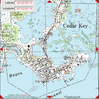
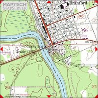
Here are two views of Cedar Key: one from www.MapTech.com and one from www.flashearth.com.
SandyBottom and DrKayak are planning to leave Cedar Key in sync with the tides; that means leaving at 10:30 AM on Friday. SandyBottom said she "knew" they could reach Ft. DeSoto on time, and probably by Saturday night.
I mentioned the fact that clocks will lose an hour this weekend. Well sure! That is consistent with the pitch-black moonless, foggy, frozen nights, unfavorable winds and contrary tides, high tech gliches, frisky manatees, stumps in the rivers and all the other wonderful jaw-dropping challenges the 2006 UFC has served up to the various challengers.
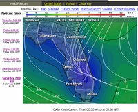
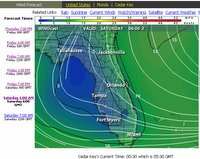
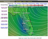
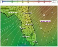
On the other hand, the 100-mile cruise from Cedar Key to Ft. DeSoto may feature flat calm waters and light breezes --at least that is what the current weather forecasts are saying. That would be a nice change. Here are forecasts from www.intellicast.com. Blue means light winds, green and yellow indicate higher winds.
Wednesday, March 29, 2006
Day26: Day Begins 125 Miles from Cedar Kay
...as reported by DancesWithSandyBottom
On Wednesday (Day26) SandyBottom was still paddling down the Suwannee River with DrKayak and RiverJohn.
Day26 started with coffee at 7:30 AM on the heels of the 70-mile effort of the previous day and the respite of 2.5 hours of sleep on a muddy slope. At this point SandyBottom was 70 miles upriver from Fanning Springs and 125 miles from the checkpoint at Cedar Key.
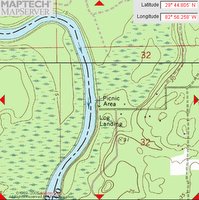
By 11:00 PM Wednesday night, the three kayakers had paddled 55 miles and were resting in their hammocks 50 miles from the Gulf of Mexico (70 miles from the checkpoint on Cedar Key. Here is a MapTech view of their 11pm campsite at a picnic area.
When they started at 7:30 AM, 125 miles from the checkpoint at Cedar Key, it was not clear whether it would be possible for the kayakers to meet the deadline for reaching the checkpoint. The deadline is 7AM Friday. They knew that staying on schedule would mean paddling about 63 miles this day and 63 miles the next day, with much of the travel being at night with no moonlight and perhaps more fog. The last 20 miles of that second 63-mile day would be in the Gulf at night time traveling south from the mouth of the Suwannee to Cedar Key; there, a north wind would help. There was, however, no doubt in anyone's mind that RiverJohn will finish Stage4 (the one stage he is doing) at Cedar Key as planned, and SandyBottom and DrKayak will finish Stage4 and Stage5 to complete the course back to Ft. DeSoto on Mullet Key in Tampa Bay. Some of the experienced WaterTribe members did not think that it was likely that SandyBottom and DrKayak would safely beat the deadline at the Cedar Key checkpoint and, perhaps wisely, advised putting safety first by avoiding sleep deprivation even if allowing enough time for sleep meant arriving late. SandyBottom and DrKayak were also contemplating their best strategies. They knew that if conditions turn out the be ideal, and they continue to average about 3.6-4.1 mph while paddling on the river and about 3.0 mph in the Gulf, then paddling 18 hours Wednesday and 19 hours Thursday would get them to Cedar Key on time. That is, of course, an absolutely grueling pace any way you look at it and it remains to be seen what reality the river and weather will throw at them this side of the checkpoint.
By 12:30 PM Wednesday SandyBottom reported while on the move that they were passing river mile marker #87 and had already paddled downstream the first 18 miles of this day. They were expecting to pass Branford, Florida, at about 3:30 PM, roughly. They reached Branford at about 4 PM and rested there briefly.
At the end of Day26 they had traveled 55 miles: from river mile marker #107 to mile marker #52.
SandyBottom reported that they were making every effort to stay on schedule: they had paddled 70 miles the previous day, 55 miles today, and were planning on paddling 70 miles the following day.
Their stated plan for Thursday (Day27) is to paddle the remaining 50 miles to the Gulf by about 6:30 PM, then rest for two hours, and then paddle the 20-mile course to the checkpoint. If all goes well, this should put them at the check point by about 2 AM on Friday (Day28). The tide schedule seems to be favorable for this plan and its timing. Wind forecasts (as of this report) were are favorable.
In any case, the three kayakers must surely have started and ended the day dreaming of riding a fast downstream current, of clear fog-less night air, and of favorable winds to greet them on the Gulf.
Tuesday, March 28, 2006
Day25: Downriver From Big Shoals on the Suwannee
...as reported by DancesWithSandyBottom
Tuesday (Day25), SandyBottom traveled 70 miles down the Suwannee from Big Shoals before calling it a day at 4 AM on Wednesday.
Check out the new videos that Chief has posted at www.watertribe.com/ChallengeViewer/default.aspx. The one called "SandyBottom - with RiverJohn and DrKayak on the St. Marys River" is about 20 minutes in length; starts out on coastal waters and ends far upstream on the river. Two other videos shot by Chief document the portage from the St. Marys River over to the Suwannee River.
SandyBottom was planning on a long day, starting at 7:30 AM and going past midnight. She is currently paddling down the Suwannee with DrKayak and RiverJohn. By mid-day she was expecting to be passing under the highway 129 bridge where ManitouCruiser is waiting to record video footage of the SandyBottom, DrKayak and RiverJohn in action. Along the way, they would also resupply at White Springs, FL, (which is a call-it-in checkpoint), and also reach a checkpoint at Suwannee River State Park boat ramp. SandyBottom reported Monday night that she and her comrades are out of coffee and may stop at the 129 bridge or at White Springs long enough to re-stock.
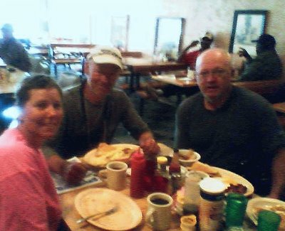
SandyBottom reported in at 10:15 AM to say that she was in White Springs at a grocery buying coffee and that she and DrKayak and RiverJohn had also had breakfast in White Springs. She sent a cellphone-camera photo taken at the breakfast.
Looks like they should have asked for a side order of "bath."
Here is a maptech view of White Springs, home of the Stephen Foster Museum.
Over the next twenty miles SandyBottom reported seeing six more alligators.
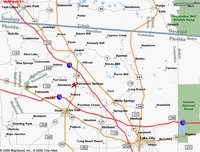
At 4:30 PM SandyBottom called in to report that "three amigos", as Chief calls them, had reached Suwannee Springs. On the bank of the river is the "Spirit of Suwannee Music Park and Campground". They were met there by a canoe carrying ManitouCruiser (MC) and the film crew. MC, et al. gave each of them goody bag containing essentials such as corn chips and (I think she said) hot fried chicken and steak sandwiches (?); anyway, it was a kind of 'happy meal'.
The immediate plan was to continue paddling until very late tonight. She said they hoped to reach Gulf waters by late Thursday and then arrive at Cedar Key (which is 20 miles down the coast) by Friday AM.
It turned out that the "three amigos" paddled through the night in pitch-black darkness and thick fog until 3 AM when it became difficult to stay wake. By that time the banks of the river were high and it was difficult to find a place to rest. It was also difficult to know which direction to paddle. The river makes tight loops so that the compass bearing of the correct course can be almost anything at any given point. There were fallen trees (strainers), fishing lines and stumps to avoid along the river banks as well as in the middle of the channel. Ultimately the three kayakers rafted together and drifted to try to avoid debris collisions while nodding off.
At about 4 AM they spotted a low point on a muddy river bank that allowed them to get out of their boats to sleep for two and a half hours on a slippery slope. At that point, which is near Charles Spring, they had traveled 69.7 miles downriver from Big Shoals.
Here is a little tribute to all the WaterTribe challengers through the years...
(With apologies to author Lowell George and to singer Linda Ronstadt...)
WaterTribe Willin'
I been whipped by the rain, driven by the flow
I'm damp and dirty, don't you know
But I'm still willin'
Out on the river late last night
I'd see the pretty gators in my headlight
sharks, manatees and gators
And I've paddled from Tampa to Key Largo
Even all the way around!
Sailed every kind of rig that's ever been made
Camped outta sight so I wouldn't be delayed
And if you give me charts, tides and time
And you show me a sign
And I'll be willin' to be movin'
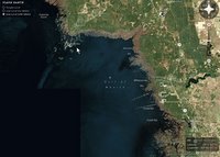
And I've been kicked by the wind, flipped off the seat
Had my head stove in but I'm still on my feet
And I'm still willin'
And I struggled at times to reach that Big Marco
Baked by the sun every time I go to Big Marco
Ah but I'm still...
And I've paddled from Tampa to Key Largo
Even all the way around!
Sailed every kind of rig that's ever been made
Camped outta sight so I wouldn't be delayed
And if you give me charts, tides and time
And you show me a sign
And I'll be willin' to be movin'
And I've paddled from Tampa to Key Largo
Even all the way around!
Sailed every kind of rig that's ever been made
Camped outta sight so I wouldn't be delayed
And if you give me charts, tides and time
And you show me a sign
And I'll be willin' to be movin'
Monday, March 27, 2006
Day24: First Day on the Suwannee River
...as reported by DancesWithSandyBottom
SandyBottom has completed two of the four parts of Stage4 of the Ultimate Florida Challenge.
She has completed the 90-mile trip up the Saint Marys River and the 40-mile portage from that river to Fargo, GA, on the banks of the Suwannee River. There remains a 220-mile trip down the Suwannee River to the Gulf, and then a 20 mile paddle south on the Gulf to checkpoint 7 on Cedar Key.
Monday (Day24) SandyBottom launched from Fargo to travel downstream (for a change) on the Suwannee River. By the end of the day, traveling with DrKayak and RiverJohn, she had traveled more than 45 miles and had completed a quarter-mile portage around Big Shoals, the only rapids in Florida. By 9:20 PM here boat was ready for an early AM launch and she was tucked into her Hennessey hammock for the night.
SandyBottom said that the river views to day included 1 wild hog, 3 alligators that dove for cover, and 1 alligator that stayed on his log to pose for her camera. After sunset the howls of coyotes could be heard. She said the river has been beautiful so far but the view changes slowly and she is looking forward to coastal kayaking in Gulf waters again. (My question is, on the other hand, isn't it nice not to have 10-foot swells and 3-foot breaking waves in your face?)
Cellphone coverage along the river from Fargo to the Gulf varies and is known to be sparse and reliable only at a few locations. Reports from SandyBottom may be infrequent.
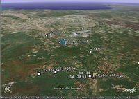
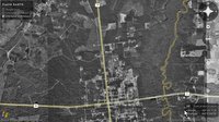
SandyBottom was able to call in at 3:10 PM and again at 9:20 PM with a clear cellphone signal. Here is a vew looking from Fargo (flag) toward her location (blue square) at 3:10 PM.
She reported that all was well and that she and DrKayak and RiverJohn were floating downriver together at about 1.5 mph as she spoke. As planned, they had rested overnight at Fargo and then started early this morning down the Suwannee. The river seemed to be flowing at (very roughly) 1.5 mph. Since starting from Fargo at 7:00 AM, they have traveled ~32 miles in ~8 hours and averaged ~ 4 mph. SB said she wants to finish the Suwannee River in 3 days and that means paddling 70 miles per day. Traveling 4 mph over the 220 miles means paddling 17.5 hours per day ---by starting at 6am and paddling at a cruising speed (2-3 mph) until midnight.
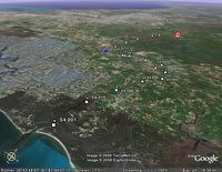
At right is a view of her location at 3:10 PM (blue square) looking back towards Fargo (flag).
SB said they were all feeling the effects of the portage effort, "we're all in a funk today... feeling lazy". They started at 7am today because it was so cold in the early pre-sunrise hours that their fingers don't work at all. It has been near freezing overnight for the past four days. The predicted low for tonight is better at 42 degrees F.
SB said the Suwannee River so far is prettier than the St Marys River and worth a return trip in the future. Here is a collection of photos available at the Suwannee River State Park's website: www.floridastateparks.org/suwanneeriver/Photos-Park.cfm
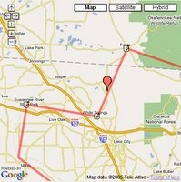
At right is the location at 3:10 PM, 32 miles downriver from Fargo. Her location at 9:20 PM, 45 miles downriver from Fargo would be located 13 miles SW of the orange pushpin.
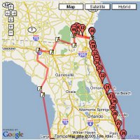
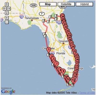
The image at the following web site gives a great overview of the Suwannee River system. SandyBottom was paddling the section just north of and down to Big Shoals today.
http://gulfsci.usgs.gov/suwannee/images/watershed2.gif
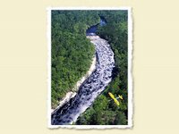
No photos yet of SandyBottom at Big Shoals today (it was dark) but there are many images of Big Shoals to be found on the web. Here are two beautiful photographs by John Moran, Florida Nature Photographer. Please visit his web site....
http://www.johnmoranphoto.com/water_005.html
His collected work on display at this website is well worth while as you might begin to see from these two fabulous examples [(c) John Moran] which focus on Big Shoals:
Sunday, March 26, 2006
Day23: The Portage
...as reported by DancesWithSandyBottom
SandyBottom began Day23 (Sunday) at 7:00 AM by figuring out a temporary way to shift her Dahon bike's 3-speed hub out of high gear. By 8:00 AM she was moving west on highway 94, using low gear to tow her boat. Shortly thereafter she passed DrKayak and RiverJohn. She reached Fargo, GA, at 1:30 PM, hungry, and stopped in a cafe to enjoy a fabulous chicken buffet special. By 2:05 PM she was riverside and was met by Chief and the film crew. A couple of hours later she was packed and ready to launch down the Suwannee River.
SandyBottom called home at about 6 PM to report that DrKayak and RiverJohn had arrived --finished their marathon-plus walks-- and the plan is for all three kayakers to camp at Fargo tonight, catch up on rest and sleep, and then launch "early" in the morning (at/before sunrise?) to paddle down river together to the Big Shoals section which offers the only class III rapids in Florida.
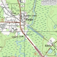
At right is a view of Fargo looking toward the Gulf on the distant horizon.
The tiny Stage4 waypoint markers in this image mark the way across Florida from Ft. Clinch in the foreground to Cedar Key on the distant horizon. In between the St. Marys River, the portage, and the Suwannee meander to the SSW. The red marker shows SandyBottom's current location in Fargo at the transition between portage and Suwannee. The blue shield marker is placed over St. George at the start of the portage.
Details
SandyBottom had traveled about 9 miles Saturday night by walking the bike with boat in tow. There remained about 31 miles to go to the Suwannee River put-in at Fargo, Georgia. In practice on a level track her best steady cruising speed was about 9 mph. If she averages half that speed the remaining miles to Fargo, she could reach the Suwannee River by about 3:00 PM. In any case, SandyBottom was expecting to arrive at the Suwannee before the end of the day, even if she had to walk the bike (with boat in tow).
It turned out that low gear worked well with the maximally loaded boat and SandyBottom was able to average 6.8 to 7.0 mph. That is excellent. She reported that it was difficult be sitting on a bike again --"it needed a Kruger Canoe seat!" For comfort she alternated between riding the bike a mile or two, walking the bike 100 yards and eating an orange.
Shen she passed DrKayak and RiverJohn at about 8:00 AM this morning, DrKayak was averaging about 2.5 mph and feeling it in a knee. RiverJohn had decided to walk rather than roller blade and was averaging 3 to 3.5 mph.
She arrived in the Fargo area at 1:30 PM, very hungry, and stopped at a cafe to have a wonderful chicken buffet. It was reported to be fabulous.
After SandyBottom packed in preparation to launch down the Suwannee, she wondered if her comrades would be arriving that day. Chief was driving back and forth on Highway 94 to check of the walkers and he would know how they were doing. She reported that her preference was to wait but was concerned that if she lingered too long at Fargo it could turn out that she would only have two days to paddle the 100-mile Stage5 sprint from Cedar Key to Ft. Desoto (in potentially unfavorable weather to boot.)
It turn out the DrKayak and RiverJohn arrived soon enough and a good plan to recharge overnight at Fargo and launch early in the AM was formulated.
Geographic Details
The westward portage along highway 94 / 2 skirts the southern boundary of Georgia's Okefenokee National Wildlife Refuge and Wilderness Area. Cellphone coverage is good near the starting point at Saint George, GA, near the cellphone tower 5 miles out, and at the end near Fargo.
The first 12 miles and the last 8 miles (roughly) of the portage are in Georgia and there the road is called Highway 94. The middle 20 miles (roughly) are in Florida and there the road is called Highway 2.
Most of the portage is relatively flat as shown by these data from Google Earth obtained at points where the highway crosses longitude lines set 36 seconds apart. (One minute of longitude equals 60 seconds of longitude). Not sure how accurate those data are. There is a cellphone tower and a radio tower on top of the "hill".
Saturday, March 25, 2006
Day22: Starting the Portage
...as reported by DancesWithSandyBottom
From 5:30 PM to 7:00 PM on Saturday (Day22) SandyBottom assembled her kayak cart, 3-speed folding bike, towing "bow sprit" and changed into biking shoes, clothes and helmet. She called at 7:00 PM ready to roll. The bike is a Dahon (www.dahon.com.) The boat cart is PaddleBoy (www.paddleboy.com).
Her clear biking glasses with rear-view mirror attached was hiding somewhere, but she thought she might stop at the grocery a mile down the road in St. George to purchase (if possible) some kind of small mirror that she could tape to the handlebar. Instead she found a small mirror in her cosmetics kit that she was able to use.
SandyBottom soon discovered found that the Dahon bike's 3-speed gear-shift cable housing had come loose during the trip such that the shifter would allow only high gear. Apparently, with everything tightly packed in the boat, the bike's gear-shift cable housing was pulled loose. It would not shift into middle or low gear. It did not seem to be repairable --probably needing a whole new cable. Because of this problem, Saturday evening and night SandyBottom was only able to travel 8.8 miles by mostly walking the bike(towing boat) and by doing some riding in high gear.
She stopped to sleep for the night at 11:40 pm on a side road about 3 miles past the cellphone tower on highway 94 made famous by other challengers' reports. It was very cold, she said.
At 8:00 am Sunday Morning she called in to report that she had used a piece of small rope or cord to pull additional tension into the gear-shift cable so that the hub would remain shifted into low gear.
She said she was now moving on to cover the miles and to see how the towing progresses in low gear. DrKayak and RiverJohn were somewhere ahead of her. If it works okay, she may be able to catch up with them on the road.
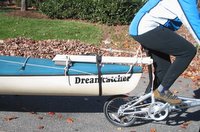
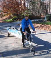
File photos of practice 12/10/05 illustrate the intended strategy for bike towing boat. The bow sprit is pvc pipe; the final version used web straps and velcro rather than ropes for the "up haul", "in haul" and "down haul" attachments to the seat post.
Day22: St Marys River, Arrival at St George
... as reported by DancesWithSandyBottom
On Saturday (Day22) SandyBottom, DrKayak and RiverJohn paddled up the last 25 miles on the St. Marys River to reach St. George, Georgia, by 5:00 PM.
SandyBottom had reported that she and DrKayak and RiverJohn were planning to paddle from 4 AM Saturday until dark toward St. George. They began the day from a white-sand campsite about 65 river-miles from CP6 and about 25 river-miles from the take-out point at St. George, FL. Traveling upstream at about 2.5 mph, they had anticipated it would take about 10 hours of paddling to reach St. George.
The air temperature was near 32 degrees F when SandyBottom awoke Saturday morning. The three kayakers finally launched their boats at 7:00 AM. This last passage up the river was challenging because of the swifter water associated with the narrowing width of the river.
By 5:00 PM they had reached the boat ramp at the bridge near St. George. "Chief" was there to greet them along with the film crew, Ms. Jenning Gee and her colleague Myrna.
In Georgia now: "Toto, I've a feeling we're not in Florida anymore."
Having reached the starting point of the 40-mile portage, it was time for the kayakers to retrieve wheels from inside their boats and make an amphibious transition to land travel. SandyBottom will be using a small fold-up bike she has been carrying as cargo. RiverJohn plans to rollerblade and push his kayak. DrKayak will be walking with his boat. Each of the three will be using a small 2-wheeled cart under their kayak --carts they have been carrying as cargo from the start of the challenge.
Here are two views of the Friday-night campsite (marked by a red dot). In the wider view several white sandbars are visible in the meanders of the river.
Cellphone coverage is weak / nonexistent in some areas along the St Marys River. Text messaging, especially to transmit GPS longitude-latitude coordinates, sometimes succeeds when voice quality is too poor.
The map of the St Marys River at right (available in full from www.sjrwmd.com/programs/outreach/pubs/smr_guide ) shows the location of the bridge at St. George where the paddlers leave the river and begin their 40-mile portage westward to the Suwannee River at Fargo, GA. The map also show the first few miles of highway 94 & 2 which is the portage route.
Temperatures have varied from a low of 31 to a high of 65 (degrees F) during the past three days in the area of the St. Marys River which marks the Georgia/Florida state line. The forecast predicts temperatures in the 34 - 65 (degrees F) range for the next few days. Although constant rain and fog were featured in the first 48 hours on the river, the sky are forecast to be clear and sunny for the next four days. That is good news for the remainder of the trip on the St. Marys River, for the 40-mile portage and for the transition from portage to launching down the Suwannee River.
Fog and darkness at night were a problem during the first two days on the river. The calendar at left shows that the kayakers currently see very little moonlight at night.
At right is a photo of the kayakers' view of the St. Marys River when paddling at night in dense fog with no moonlight and no lights turned on...
And here is a photo of the very same view when the kayaker snaps on her head lamp... Hmmmmmm .........
SandyBottom, DrKayak and RiverJohn took their boats out of the St. Marys River at the boat ramp next to the Highway 94 / Highway 2 bridge. To the east of the river the road is in Florida and is called Highway 2. To the west of the river the road is in Georgia and is called Highway 94.
While they were busy with becoming amphibious, "Chief" and the film crew drove to town to buy some "take out" hamburgers for everyone.
Here is a close-up view of the boat ramp (dirt road) running parallel to Highway 94.
Friday, March 24, 2006
Day21: St Marys River in Daylight
... as reported by DancesWithSandyBottom
Friday (Day21), SandyBottom and the other two kayakers, DrKayak and RiverJohn, launched at 9 AM --having stayed out much to late into the wee hours on the dark river Thursday night. They passed a minor checkpoint, Trader Hill, at 3:15 PM and kept going to take advantage of the tidal flow and daylight.
The St. Marys River is affected by coastal tides as far as 50 miles up river.
They stopped for the day at 7:40 PM pitching their tents / hammocks about 45 miles up-river from CP6 on Ft. Clinch at the mouth of the St Marys. Their plan was to sleep for about 7 hours, rise at 3 AM and start paddling toward St. George, GA, by 4 AM.
In the second half of their St Marys River route, the river becomes narrow and winding and rises more steeply. The river meanders in loops, S-turns and ox bows. "Wizard" the first through the area in this race, offered that the way to tell which way to go when the river becomes comfusing is to follow the fastest flow --paddling upstream of course.
The web sites www.stmarysriver.org and sjrwmd.com are excellent sources of information about the river.
This view from www.FlashEarth.com shows the approach to Ft. Clinch State Park from the south up the ICW. It also shows the westward route from Ft. Clinch into the St. Marys River. Only the first 15 miles (as the crow flies) of the river are shown in this view.
Wednesday, March 22, 2006
Day20: St. Marys River, First 24 Hours
... as reported by DancesWithSandyBottom.
SandyBottom started paddling up the St. Marys River at 7:00 AM on Thursday (Day20), March 23 with DrKayak and RiverJohn.
So begins Stage4.
By 5:30 PM they had traveled 25 miles.
By 10:45 she said they were inching forward in pitch black darkness in a thick fog.
Although each of the kayakers could see absolutely nothing through the fog and darkness using their own headlamps, each of them could see where to go by the lights of the other two kayakers' headlamps. All three were glad they were not paddling alone.
Due to lack of any visibility and lack of suitable campsites in the area, the three kayakers sat in their boats at a tiny sandbar from 11pm to 1am waiting for the tide to change. The temperature was near freezing. As more of the sandbar became exposed, they made a warming fire and had some hot tea and hot food. At 2:30 AM (now Friday) the tide was coming in to put out the fire. They launched and paddled onward with the inflowing tide. Soon they had trouble staying awake and all kept colliding with logs in the river. A 5:30 AM (Friday) they fond a very nice beach campsite, readied their hammocks / tents, and went to sleep for almost four hours.
Stage4 take the challengers across Florida, southwestward from the Atlantic Coast to the Gulf Coast. The Stage4 route includes a 90 statute mile paddle up the St. Marys River, a 40 mile portage from St. George, GA, down the Suwannee River.
Day19: Jacksonville to CP6 at Fort Clinch
... as reported by DancesWithSandyBottom
SandyBottom paddled 30 miles into a 13 mph headwind today, Day19 (Wednesday), to reach Ft. Clinch in the afternoon. She was delighted to arrive before sunset. She was even more delighted to learn that RiverJohn and DrKayak were still at CP6 and were waiting for her so that they could all start Stage4 together on Thursday morning.
SandyBottom started the day paddling at 1:00 AM and had traveled 7 miles by 4:30 AM. The winds were chilling and strong. For most of the day the winds were NNW or N at about 13 mph. She said it was very difficult paddling into the headwind. In the section where the ICW cuts across the St. John River, SandyBottom said she only averaged 0.8 mph. She said she was glad she had timed that crossing so that it occured during daylight hours.
Ft. Clinch State Park is quite beautiful and its campgrounds are in high demand. Chief had made sure a campsite was available for the challengers. Wednesday evening SandyBottom enjoyed the hot showers, made good use of the laundry, organized her gear, replinished her supplies, and enjoyed downtime with folks at the campsite --film photographer Jennings Gee, RiverJohn, DrKayak and DancesWithSandyBottom.
RiverJohn at the campsite --ready to roll.
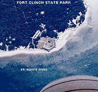
Ft. Clinch sits on the northern tip of Fernandina Beach island on the mouth of the St. Marys River.
Stage3 ends and Stage4 begins here.
Tuesday, March 21, 2006
Day18: from St. Augustine to Jacksonville
... as reported by DancesWithSandyBottom
Tuesday, March 21, SandyBottom started out at 4 AM from St. Augustine 60 miles from CP6 at Fort Clinch.
By 2:30 PM she had paddled 30 miles and the tailwind had built up to 20 mph.
Tuesday, March 21, SandyBottom started out at 4 AM from St. Augustine 60 miles from CP6 at Fort Clinch.
By 2:30 PM she had paddled 30 miles and the tailwind had built up to 20 mph.
She stopped to camp and rest (at 2:30 PM) for a few hours at a point on the ICW that is just west of Jacksonville Beach --30 miles from CP6.
Here is the view from St. Augustine looking north toward CP6 on the horizon. In the lower center part of the image is the fortress, Castillo de San Marcos.
Winds were from the favorable southeast at 5 to 10 mph before sunrise. By 8 AM the winds had increased to 13 mph. A weather front was on the way and expected to move through the St. Augustine area today by mid-day. Winds continued to build to 20 mph by 1pm with gusts up to 35 mph.
The forecast for Tuesday evening predicted subsiding winds changing to flow from the west.
SandyBottom started the day paddling at 4 AM and crossed through the harbor and inlet area --before conditions could get out of hand. She was well out of St. Augustine and into narrow (~ 1/10 mile wide) of the ICW before conditions became unsafe. She continue paddling north on the ICW until it was all froth and whitecaps whipped by swirling gusts.
At 2:30 PM she got off the water (for camping and sleeping) for a few hours and called home at 2:30 PM and 5:00 PM. She tried to sleep from 5:00 PM to midnight.
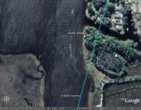
View from here camp site looking toward CP6 30 miles to the north.
Close-up view of camp site (south=up) Here is the view from St. Augustine looking north toward CP6 on the horizon. In the lower center part of the image is the fortress, Castillo de San Marcos.
Winds were from the favorable southeast at 5 to 10 mph before sunrise. By 8 AM the winds had increased to 13 mph. A weather front was on the way and expected to move through the St. Augustine area today by mid-day. Winds continued to build to 20 mph by 1pm with gusts up to 35 mph.
The forecast for Tuesday evening predicted subsiding winds changing to flow from the west.
SandyBottom started the day paddling at 4 AM and crossed through the harbor and inlet area --before conditions could get out of hand. She was well out of St. Augustine and into narrow (~ 1/10 mile wide) of the ICW before conditions became unsafe. She continue paddling north on the ICW until it was all froth and whitecaps whipped by swirling gusts.
At 2:30 PM she got off the water (for camping and sleeping) for a few hours and called home at 2:30 PM and 5:00 PM. She tried to sleep from 5:00 PM to midnight.
View from here camp site looking toward CP6 30 miles to the north.
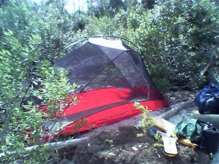
Cell-camera photo of her tent.
Subscribe to:
Posts (Atom)