SandyBottom began Day23 (Sunday) at 7:00 AM by figuring out a temporary way to shift her Dahon bike's 3-speed hub out of high gear. By 8:00 AM she was moving west on highway 94, using low gear to tow her boat. Shortly thereafter she passed DrKayak and RiverJohn. She reached Fargo, GA, at 1:30 PM, hungry, and stopped in a cafe to enjoy a fabulous chicken buffet special. By 2:05 PM she was riverside and was met by Chief and the film crew. A couple of hours later she was packed and ready to launch down the Suwannee River.
SandyBottom called home at about 6 PM to report that DrKayak and RiverJohn had arrived --finished their marathon-plus walks-- and the plan is for all three kayakers to camp at Fargo tonight, catch up on rest and sleep, and then launch "early" in the morning (at/before sunrise?) to paddle down river together to the Big Shoals section which offers the only class III rapids in Florida.
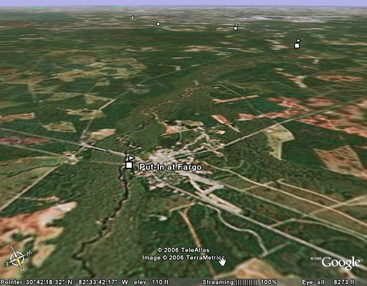
At right is a view of Fargo looking toward the Gulf on the distant horizon.
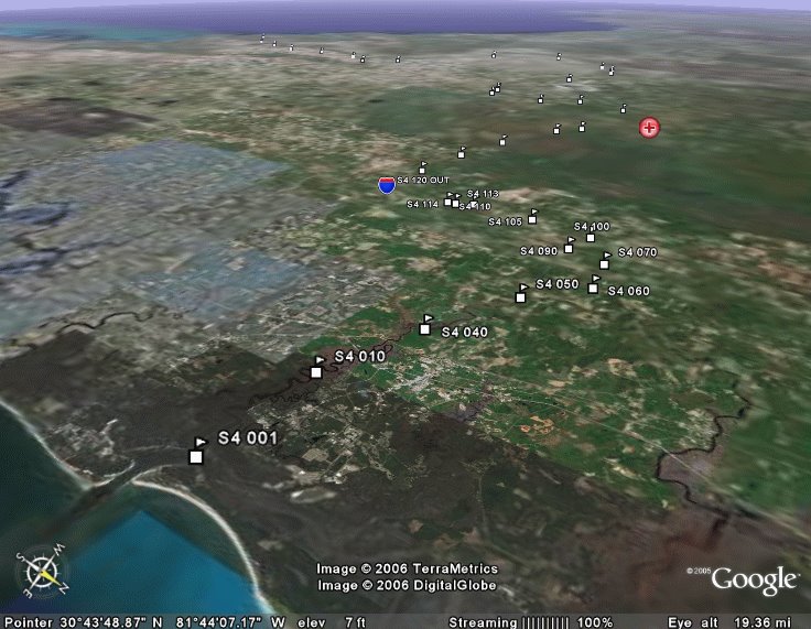
The tiny Stage4 waypoint markers in this image mark the way across Florida from Ft. Clinch in the foreground to Cedar Key on the distant horizon. In between the St. Marys River, the portage, and the Suwannee meander to the SSW. The red marker shows SandyBottom's current location in Fargo at the transition between portage and Suwannee. The blue shield marker is placed over St. George at the start of the portage.
Details
SandyBottom had traveled about 9 miles Saturday night by walking the bike with boat in tow. There remained about 31 miles to go to the Suwannee River put-in at Fargo, Georgia. In practice on a level track her best steady cruising speed was about 9 mph. If she averages half that speed the remaining miles to Fargo, she could reach the Suwannee River by about 3:00 PM. In any case, SandyBottom was expecting to arrive at the Suwannee before the end of the day, even if she had to walk the bike (with boat in tow).
It turned out that low gear worked well with the maximally loaded boat and SandyBottom was able to average 6.8 to 7.0 mph. That is excellent. She reported that it was difficult be sitting on a bike again --"it needed a Kruger Canoe seat!" For comfort she alternated between riding the bike a mile or two, walking the bike 100 yards and eating an orange.
Shen she passed DrKayak and RiverJohn at about 8:00 AM this morning, DrKayak was averaging about 2.5 mph and feeling it in a knee. RiverJohn had decided to walk rather than roller blade and was averaging 3 to 3.5 mph.
She arrived in the Fargo area at 1:30 PM, very hungry, and stopped at a cafe to have a wonderful chicken buffet. It was reported to be fabulous.
 After SandyBottom packed in preparation to launch down the Suwannee, she wondered if her comrades would be arriving that day. Chief was driving back and forth on Highway 94 to check of the walkers and he would know how they were doing. She reported that her preference was to wait but was concerned that if she lingered too long at Fargo it could turn out that she would only have two days to paddle the 100-mile Stage5 sprint from Cedar Key to Ft. Desoto (in potentially unfavorable weather to boot.)
It turn out the DrKayak and RiverJohn arrived soon enough and a good plan to recharge overnight at Fargo and launch early in the AM was formulated.
Geographic Details
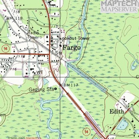
The westward portage along highway 94 / 2 skirts the southern boundary of Georgia's Okefenokee National Wildlife Refuge and Wilderness Area. Cellphone coverage is good near the starting point at Saint George, GA, near the cellphone tower 5 miles out, and at the end near Fargo.
The first 12 miles and the last 8 miles (roughly) of the portage are in Georgia and there the road is called Highway 94. The middle 20 miles (roughly) are in Florida and there the road is called Highway 2.

Most of the portage is relatively flat as shown by these data from Google Earth obtained at points where the highway crosses longitude lines set 36 seconds apart. (One minute of longitude equals 60 seconds of longitude). Not sure how accurate those data are. There is a cellphone tower and a radio tower on top of the "hill".


No comments:
Post a Comment