Thursday (Day27) began at mile marker #52. The first goal for Day27 is to reach the Gulf (passing marker #1) by 6:30 PM. Along the way, they would pass Fanning Springs (at #35). The second goal for the day was to reach the checkpoint at Cedar Key by an hour or two past midnight. SandyBottom paddled downriver and in the Gulf from 5:30 AM Thursday to 1:35 AM Friday and reached the checkpoint on Cedar Key. The day's tripmeter read 67.5 miles. Having paddled for 20 hours, that translates as about 3.38 mph. She made the journey in good company with DrKayak and RiverJohn.
 This image from www.flashearth.com gives an overview of the Suwannee River from Fanning Springs to the Gulf and also shows the location of Cedar Key.
The white arrows highlight Fanning Springs in the north, their exit from the river delta to the south, and Cedar Key 20 miles SE of the exit.
At 6:30 PM SandyBottom spoke very briefly by cellphone to report her position at the mouth of the Suwannee River. She reported that she and her amigos were paddling immediately the 20 miles of Gulf waters to Cedar Kay. She said they expected to arrive at that checkpoint between 1:00 AM and 2:00 AM (Friday morning). And she did.
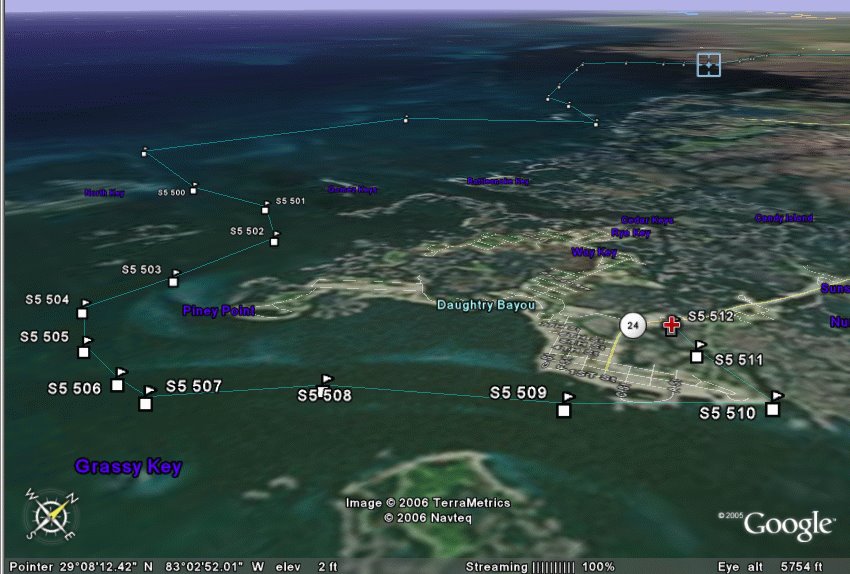
Here is a view from Cedar Key (red mark) looking back towards the delta of the Suwannee River (blue mark). The marked route follows channels around Cedar Key.
And so SandyBottom, DrKayak and RiverJohn all arrived safely at the Cedar Key checkpoint at about 1:35 AM 3/31/06. They had stopped for 10 minutes at Fowler's Bluff along the way.
SandyBottom reported that they had benefited from favorable out-going tide leaving the Suwannee River, and from favorable in-coming tide approaching Cedar Key. They were not hampered by fog today. (Hooray!) Weather and wave conditions were calm. (Yes!)
I conveyed messages and encouragements that had been posted by Chief and others.
RiverJohn's wife had come to Cedar Key looking for him and was on hand when he arrived.
I asked about RiverJohn's sprayskirt. SandyBottom reported that RiverJohn had several kinds of safety gear activated for the Gulf waters. I'll leave it to RiverJohn to describe all that. Apparently, SandyBottom and DrKayak had felt that RiverJohn was adequately set up for safe passage under the exisiting weather conditions. Of course, status on being officially cleared gear-wise is a completely separate assessment that is rests entirely in the hands of race management.
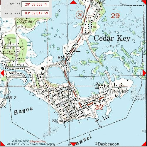
 Here are two views of Cedar Key: one from www.MapTech.com and one from www.flashearth.com.
SandyBottom and DrKayak are planning to leave Cedar Key in sync with the tides; that means leaving at 10:30 AM on Friday. SandyBottom said she "knew" they could reach Ft. DeSoto on time, and probably by Saturday night.
I mentioned the fact that clocks will lose an hour this weekend. Well sure! That is consistent with the pitch-black moonless, foggy, frozen nights, unfavorable winds and contrary tides, high tech gliches, frisky manatees, stumps in the rivers and all the other wonderful jaw-dropping challenges the 2006 UFC has served up to the various challengers.
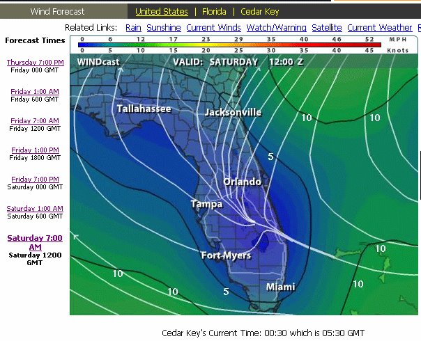
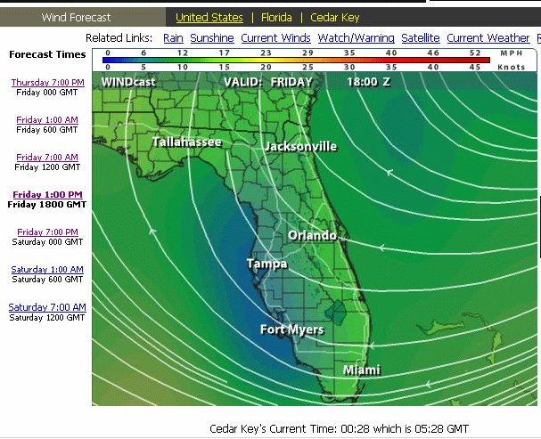
On the other hand, the 100-mile cruise from Cedar Key to Ft. DeSoto may feature flat calm waters and light breezes --at least that is what the current weather forecasts are saying. That would be a nice change. Here are forecasts from www.intellicast.com. Blue means light winds, green and yellow indicate higher winds.


No comments:
Post a Comment