On Saturday (Day22) SandyBottom, DrKayak and RiverJohn paddled up the last 25 miles on the St. Marys River to reach St. George, Georgia, by 5:00 PM.
SandyBottom had reported that she and DrKayak and RiverJohn were planning to paddle from 4 AM Saturday until dark toward St. George. They began the day from a white-sand campsite about 65 river-miles from CP6 and about 25 river-miles from the take-out point at St. George, FL. Traveling upstream at about 2.5 mph, they had anticipated it would take about 10 hours of paddling to reach St. George.
The air temperature was near 32 degrees F when SandyBottom awoke Saturday morning. The three kayakers finally launched their boats at 7:00 AM. This last passage up the river was challenging because of the swifter water associated with the narrowing width of the river.
By 5:00 PM they had reached the boat ramp at the bridge near St. George. "Chief" was there to greet them along with the film crew, Ms. Jenning Gee and her colleague Myrna.
In Georgia now: "Toto, I've a feeling we're not in Florida anymore."
Having reached the starting point of the 40-mile portage, it was time for the kayakers to retrieve wheels from inside their boats and make an amphibious transition to land travel. SandyBottom will be using a small fold-up bike she has been carrying as cargo. RiverJohn plans to rollerblade and push his kayak. DrKayak will be walking with his boat. Each of the three will be using a small 2-wheeled cart under their kayak --carts they have been carrying as cargo from the start of the challenge.
Here are two views of the Friday-night campsite (marked by a red dot).
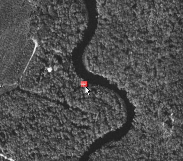 In the wider view several white sandbars are visible in the meanders of the river.
Cellphone coverage is weak / nonexistent in some areas along the St Marys River. Text messaging, especially to transmit GPS longitude-latitude coordinates, sometimes succeeds when voice quality is too poor.
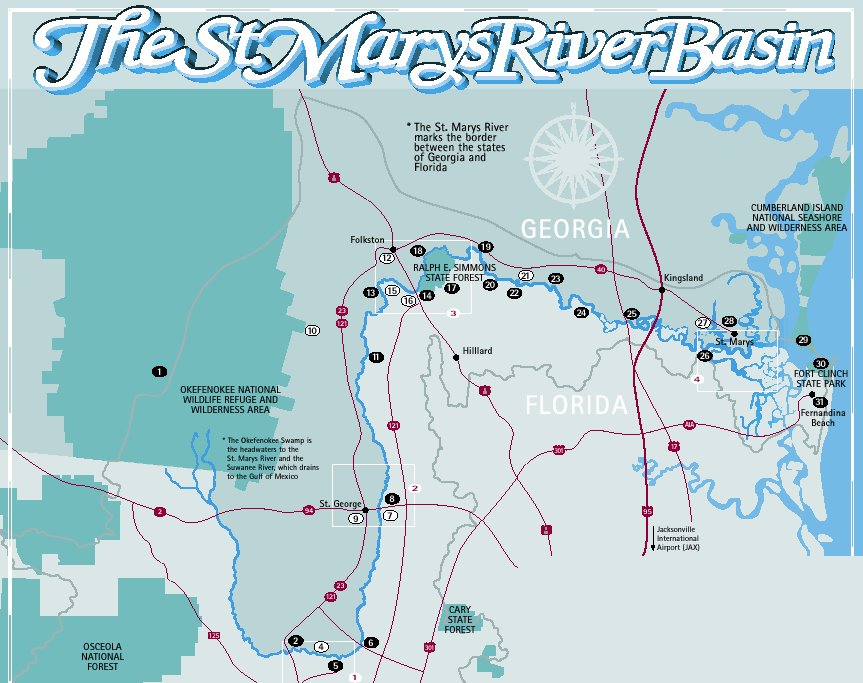 The map of the St Marys River at right (available in full from www.sjrwmd.com/programs/outreach/pubs/smr_guide ) shows the location of the bridge at St. George where the paddlers leave the river and begin their 40-mile portage westward to the Suwannee River at Fargo, GA. The map also show the first few miles of highway 94 & 2 which is the portage route.
Temperatures have varied from a low of 31 to a high of 65 (degrees F) during the past three days in the area of the St. Marys River which marks the Georgia/Florida state line. The forecast predicts temperatures in the 34 - 65 (degrees F) range for the next few days. Although constant rain and fog were featured in the first 48 hours on the river, the sky are forecast to be clear and sunny for the next four days. That is good news for the remainder of the trip on the St. Marys River, for the 40-mile portage and for the transition from portage to launching down the Suwannee River.
 Fog and darkness at night were a problem during the first two days on the river. The calendar at left shows that the kayakers currently see very little moonlight at night.
At right is a photo of the kayakers' view of the St. Marys River when paddling at night in dense fog with no moonlight and no lights turned on...
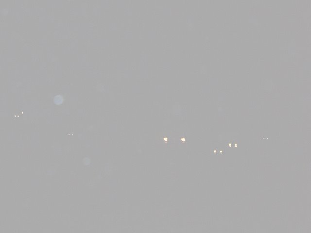 And here is a photo of the very same view when the kayaker snaps on her head lamp... Hmmmmmm .........
SandyBottom, DrKayak and RiverJohn took their boats out of the St. Marys River at the boat ramp next to the Highway 94 / Highway 2 bridge. To the east of the river the road is in Florida and is called Highway 2. To the west of the river the road is in Georgia and is called Highway 94.

While they were busy with becoming amphibious, "Chief" and the film crew drove to town to buy some "take out" hamburgers for everyone.
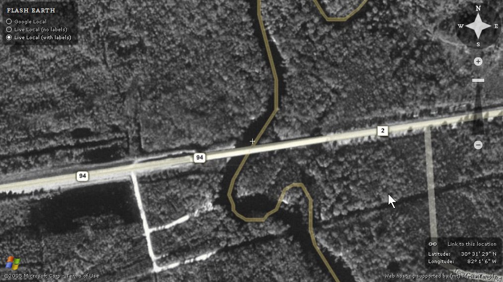
Here is a close-up view of the boat ramp (dirt road) running parallel to Highway 94.
 Here is a true-color aerial of the St. George area.


No comments:
Post a Comment