Friday (Day21), SandyBottom and the other two kayakers, DrKayak and RiverJohn, launched at 9 AM --having stayed out much to late into the wee hours on the dark river Thursday night. They passed a minor checkpoint, Trader Hill, at 3:15 PM and kept going to take advantage of the tidal flow and daylight.
The St. Marys River is affected by coastal tides as far as 50 miles up river.
They stopped for the day at 7:40 PM pitching their tents / hammocks about 45 miles up-river from CP6 on Ft. Clinch at the mouth of the St Marys. Their plan was to sleep for about 7 hours, rise at 3 AM and start paddling toward St. George, GA, by 4 AM.
In the second half of their St Marys River route, the river becomes narrow and winding and rises more steeply. The river meanders in loops, S-turns and ox bows. "Wizard" the first through the area in this race, offered that the way to tell which way to go when the river becomes comfusing is to follow the fastest flow --paddling upstream of course.
The web sites www.stmarysriver.org and sjrwmd.com are excellent sources of information about the river.
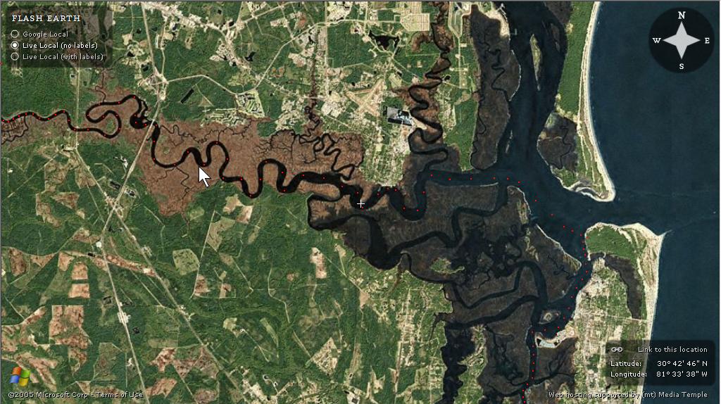
This view from www.FlashEarth.com shows the approach to Ft. Clinch State Park from the south up the ICW. It also shows the westward route from Ft. Clinch into the St. Marys River. Only the first 15 miles (as the crow flies) of the river are shown in this view.


No comments:
Post a Comment